File:African continent-de.png
From Wikimedia Commons, the free media repository
Jump to navigation
Jump to search

Size of this preview: 635 × 600 pixels. Other resolutions: 254 × 240 pixels | 508 × 480 pixels | 813 × 768 pixels | 1,084 × 1,024 pixels | 2,000 × 1,889 pixels.
Original file (2,000 × 1,889 pixels, file size: 884 KB, MIME type: image/png)
File information
Structured data
Captions
Captions
Add a one-line explanation of what this file represents
Summary[edit]
| DescriptionAfrican continent-de.png |
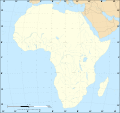
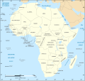
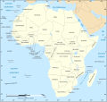
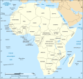
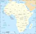
Deutsch: Politische Karte von Afrika (deutschsprachig, verbesserte Rastergrafik, für eine ähnliche SVG-Version siehe Image:African_continent-de.svg)
English: Political map of the African Continent with improved German caption, raster version of Image:African_continent-de.svg
Français : Version bitmap du carte politique du continent africain avec légende en allemand
Norsk bokmål: Politisk kart over Afrika på tysk. (PNG versjon) |
| Date | 16 March 2008 |
| Source | Image:African_continent-de.svg |
| Author | Eric Gaba, Jörg Schwerdtfeger |
| Other versions |
[edit] |
![]() This PNG graphic was created with Inkscape .
This PNG graphic was created with Inkscape .
Licensing[edit]

|
Permission is granted to copy, distribute and/or modify this document under the terms of the GNU Free Documentation License, Version 1.2 or any later version published by the Free Software Foundation; with no Invariant Sections, no Front-Cover Texts, and no Back-Cover Texts. A copy of the license is included in the section entitled GNU Free Documentation License.http://www.gnu.org/copyleft/fdl.htmlGFDLGNU Free Documentation Licensetruetrue |
| This file is licensed under the Creative Commons Attribution-Share Alike 3.0 Unported license. | ||
| ||
| This licensing tag was added to this file as part of the GFDL licensing update.http://creativecommons.org/licenses/by-sa/3.0/CC-BY-SA-3.0Creative Commons Attribution-Share Alike 3.0truetrue |
File history
Click on a date/time to view the file as it appeared at that time.
| Date/Time | Thumbnail | Dimensions | User | Comment | |
|---|---|---|---|---|---|
| current | 21:32, 11 March 2018 |  | 2,000 × 1,889 (884 KB) | Maphobbyist (talk | contribs) | South Sudan border |
| 22:48, 16 March 2008 |  | 1,390 × 1,295 (667 KB) | Schwerdtfeger (talk | contribs) | == Beschreibung == {{Information |Description= {{de|Politische Karte von Afrika (deutschsprachig, verbesserte Rastergrafik, für eine ähnliche SVG-Version siehe Image:African_continent-de.svg)}} {{en|Political map of the [[:en:Africa| |
You cannot overwrite this file.
File usage on Commons
There are no pages that use this file.
