Category:Maps
Jump to navigation
Jump to search
 The article Maps on Wikipedia projects:

- (en) Map
- (an) Mapa
- (ar) خريطة
- (ast) Mapa
- (bg) Карта
- (bn) মানচিত্র
- (bs) Karta
- (ca) Plànol
- (cs) Mapa
- (cy) Map
- (da) Kort (geografi)
- (de) Karte (Kartografie)
- (eo) Mapo
- (es) Mapa
- (et) Kaart (kartograafia)
- (fa) نقشه
- (fi) Kartta
- (fr) Carte géographique
- (gan) 地圖
- (gl) Mapa
- (he) מפה
- (hi) मानचित्र
- (hr) Karta
- (hu) Térkép
- (id) Peta
- (is) Kort
- (it) Mappa
- (ja) 地図
- (ka) გეოგრაფიული რუკა
- (ko) 지도
- (la) Tabula geographica
- (lb) Landkaart
- (lt) Žemėlapis
- (ml) ഭൂപടം
- (ms) Peta
- (nl) Kaart (cartografie)
- (nn) Kart
- (no) Kart
- (oc) Mapa
- (pl) Mapa
- (pt) Mapa
- (ro) Hartă
- (ru) Географическая карта
- (sa) Хаарта
- (sco) Cairt
- (si) ple:Map
- (sk) Mapa
- (sl) Zemljevid
- (sq) Harta
- (sr) Карта (мапа)
- (su) Atlas
- (sv) Karta
- (sw) Ramani
- (ta) நிலப்படம்
- (tg) Харита
- (th) แผนที่
- (tl) Mapa
- (tr) Harita
- (uk) Географічна карта
- (vi) Bản đồ
- (yi) מאפע
- (zh) 地图
- (zh-classical) 地圖
- (zh-yue) 地圖
Before changing or adding maps, please read the brief guideline on the organizational schema About this Category developed during an eight month effort by a working group in 2007–2008.
- See also maps needing categories in Category:Unidentified maps
- See also these related categories: (These categories may contain more maps. Please categorize them in map categories.)
- Category:Cartography – for map symbols, projections, etc.
- Category:Demography
- Category:Geography
- Category:Aerial photographs
- Category:Satellite pictures
- Category:Astronomical maps – maps and star charts
- Category:Cartographic reliefs for models of landscape profiles
Resources:
visual representation of a concept space; symbolic depiction emphasizing relationships between elements of some space, such as objects, regions, or themes  | |||
| Upload media | |||
| Pronunciation audio | |||
|---|---|---|---|
| Instance of | type of map | ||
| Subclass of | cartographic work, cartographic material, two-dimensional visual artwork, visualization | ||
| Part of | map series | ||
| |||
Subcategories
This category has the following 30 subcategories, out of 30 total.
!
*
?
A
B
D
E
I
L
- Lingua Libre maps (3 F)
M
N
- Maps needing a scale (10 F)
O
P
R
- Map reading (9 F)
S
Media in category "Maps"
The following 63 files are in this category, out of 63 total.
 BlankWorldMap-Political.svg 2,754 × 1,398; 988 KB
 Cartes departement origine 1808.pdf 2,481 × 1,754; 1,003 KB
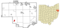
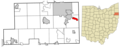
 Columbiana County Ohio incorporated and unincorporated areas Calcutta highlighted.png 3,259 × 1,536; 541 KB
 Columbiana County Ohio incorporated and unincorporated areas Columbiana highlighted.png 3,259 × 1,536; 543 KB
 Columbiana County Ohio incorporated and unincorporated areas Damascus highlighted.png 3,259 × 1,536; 543 KB
 Columbiana County Ohio incorporated and unincorporated areas Glenmoor highlighted.png 3,259 × 1,536; 543 KB
 Columbiana County Ohio incorporated and unincorporated areas Hanoverton highlighted.png 3,259 × 1,536; 543 KB
 Columbiana County Ohio incorporated and unincorporated areas Homeworth highlighted.png 3,259 × 1,536; 543 KB
 Columbiana County Ohio incorporated and unincorporated areas LaCroft highlighted.png 3,259 × 1,536; 543 KB
 Columbiana County Ohio incorporated and unincorporated areas Leetonia highlighted.png 3,259 × 1,536; 543 KB
 Columbiana County Ohio incorporated and unincorporated areas Lisbon highlighted.png 3,259 × 1,536; 542 KB
 Columbiana County Ohio incorporated and unincorporated areas Negley highlighted.png 3,259 × 1,536; 543 KB
 Columbiana County Ohio incorporated and unincorporated areas Rogers highlighted.png 3,259 × 1,536; 549 KB
 Columbiana County Ohio incorporated and unincorporated areas Salem highlighted.png 3,259 × 1,536; 543 KB
 Columbiana County Ohio incorporated and unincorporated areas Salineville highlighted.png 3,259 × 1,536; 543 KB
 Columbiana County Ohio incorporated and unincorporated areas Summitville highlighted.png 3,259 × 1,536; 543 KB
 Columbiana County Ohio incorporated and unincorporated areas Wellsville highlighted.png 3,259 × 1,536; 543 KB
 DAĞLIK KARABAĞ SON DURUM.jpg 1,313 × 758; 605 KB
 DreadnoughtMapa.jpg 2,274 × 1,536; 305 KB
 Dundee City Council 2017 results by ward.png 3,996 × 1,988; 658 KB
 Hilbert DImension visa policy.png 1,425 × 625; 42 KB
 K2mark.jpg 3,024 × 4,032; 2.23 MB
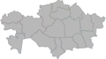 Kazakhstan regions empty 2022.png 1,200 × 671; 164 KB
 La Beauce en France.jpg 2,710 × 2,513; 1.02 MB
 La Gâtine Tourangelle en France.jpg 2,710 × 2,513; 1.02 MB
 La Sologne en France.jpg 2,710 × 2,513; 1.09 MB
 Land of Oz in Wicked play in London Theatre.jpg 1,600 × 1,049; 897 KB
 Le Blésois en France.jpg 2,710 × 2,513; 975 KB
 Le Val de Loire Orléanais en France.jpg 2,710 × 2,513; 1.02 MB
 Le Val de Loire Tourangeau en France.jpg 2,710 × 2,513; 1.02 MB
 Location of Lomoria within South America.png 339 × 402; 95 KB
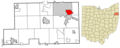
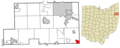
 Mahoning County Ohio incorporated and unincorporated areas Austintown highlighted.png 3,054 × 1,237; 461 KB
 Mahoning County Ohio incorporated and unincorporated areas Beloit highlighted.png 3,054 × 1,237; 461 KB
 Mahoning County Ohio incorporated and unincorporated areas Boardman highlighted.png 3,054 × 1,237; 461 KB
 Mahoning County Ohio incorporated and unincorporated areas Campbell highlighted.png 3,054 × 1,237; 461 KB
 Mahoning County Ohio incorporated and unincorporated areas Canfield highlighted.png 3,054 × 1,237; 460 KB
 Mahoning County Ohio incorporated and unincorporated areas Craig Beach highlighted.png 3,054 × 1,237; 461 KB
 Mahoning County Ohio incorporated and unincorporated areas East Alliance highlighted.png 3,054 × 1,237; 461 KB
 Mahoning County Ohio incorporated and unincorporated areas Lake Milton highlighted.png 3,054 × 1,237; 461 KB
 Mahoning County Ohio incorporated and unincorporated areas Lowellville highlighted.png 3,054 × 1,237; 461 KB
 Mahoning County Ohio incorporated and unincorporated areas Maple Ridge highlighted.png 3,054 × 1,237; 461 KB
 Mahoning County Ohio incorporated and unincorporated areas North Lima highlighted.png 3,054 × 1,237; 460 KB
 Mahoning County Ohio incorporated and unincorporated areas Petersburg highlighted.png 3,054 × 1,237; 461 KB
 Mahoning County Ohio incorporated and unincorporated areas Poland highlighted.png 3,054 × 1,237; 461 KB
 Mahoning County Ohio incorporated and unincorporated areas Sebring highlighted.png 3,054 × 1,237; 461 KB
 Mahoning County Ohio incorporated and unincorporated areas Struthers highlighted.png 3,054 × 1,237; 461 KB
 Mahoning County Ohio incorporated and unincorporated areas Woodworth highlighted.png 3,054 × 1,237; 461 KB
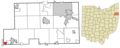
 Mahoning County Ohio incorporated and unincorporated areas Youngstown highlighted.png 3,054 × 1,237; 461 KB
 Map of the Republic of Rino Island.png 2,232 × 3,432; 2 MB
 Screenshot-algyt.123.png 639 × 409; 102 KB
 Sketch-mapofrelathionsabkhazia124.png 2,128 × 1,080; 339 KB
 Trasa rejsu Chatki Puchatków przez Atlantyk.png 800 × 976; 144 KB
 Карта войны в Донбассе 2022.png 1,080 × 1,416; 786 KB


